geocat.ch
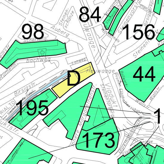
Bebauungsplan 2016
Bebauungsplan des Kantons Basel-Stadt von 2016
Simple
Identification info
- Date (Creation)
- 2019-10-02
Cited responsible party
Responsible party
- Organisation name
-
Kanton Basel-Stadt
- Position name
-
Bau- und Verkehrsdepartement
- Voice
-
+41 (0)61 267 92 25
Address
- City
-
Basel
- Postal code
-
4052
- Country
-
CH
- Electronic mail address
- Streetname
-
Dufourstrasse
- Streetnumber
-
40/50
- Protocol
-
WWW:LINK
- Role
- Author
- First Name
-
Städtebau & Architektur
- Last Name
-
Planungsamt
- Organisation Acronym
-
BS-BVD-S+A-P
- Collective title
-
Historische Pläne
- Status
- Completed
Point of contact
Responsible party
- Organisation name
-
Kanton Basel-Stadt
- Position name
-
Bau- und Verkehrsdepartement
- Voice
-
+41 (0)61 267 92 25
Address
- City
-
Basel
- Postal code
-
4052
- Country
-
CH
- Electronic mail address
- Streetname
-
Dufourstrasse
- Streetnumber
-
40/50
- Protocol
-
WWW:LINK
- Role
- Owner
- First Name
-
Städtebau & Architektur
- Last Name
-
Planungsamt
- Organisation Acronym
-
BS-BVD-S+A-P
- Maintenance and update frequency
- Not planned
-
geocat.ch
-
-
historic map
-
-
geocat.ch
-
-
opendata.swiss
-
-
GEMET
-
-
allocation plan
-
- Other constraints
-
Die Geodaten sind öffentlich zugänglich. (Zugangsberechtigungsstufe [A] = öffentlich)
- Other constraints
-
Es gelten die Nutzungsbedingungen für Geodaten des Kantons Basel-Stadt. ( http://www.geo.bs.ch/agb)
- Aggregate Datasetindentifier
- 5ec2356b-c587-4324-b446-a985cc79dea5
- Association Type
- Description
- Spatial representation type
- Grid
- Distance
- 0.5 m
- Denominator
- 10000
- Language
- Deutsch
- Character set
- UTF8
- Topic category
-
- E Spatial Planning, Cadastre
- E1 Spatial Planning, Spatial Development
Extent
- Description
-
Basel
))

- Geodata Type
- Open Data
- Distribution format
-
-
INTERLIS 1 (ITF)
()
-
INTERLIS 1 (ITF)
()
- OnLine resource
-
MapBS
(
CHTOPO:specialised-geoportal
)
Öffentliches Auskunftssystem des Kantons Basel-Stadt
- OnLine resource
-
WMS BS
(
OGC:WMS
)
Die derzeit im WMS BS verfügbaren Datenebenen entsprechen, bis auf wenige Ausnahmen, den Geodaten, welche auch in MapBS dargestellt sind. Der WMS BS ist kostenlos nutzbar und bietet Zugriff auf öffentliche sowie beschränkt öffentliche Geodaten, wobei gegebenenfalls Benutzername und Passwort benötigt werden (Zugangsdaten von MapBS).
- OnLine resource
-
Permalink opendata.swiss
(
OPENDATA:SWISS
)
Permalink opendata.swiss
- Reference system identifier
- CH1903+ / LV95 / EPSG: 2056
Metadata
- Metadata language
- Deutsch
- Character set
- UTF8
- Hierarchy level
- Dataset
- Date stamp
- 2023-01-20T13:47:38.166Z
- Metadata standard name
-
GM03 Basel-Stadt
- Metadata standard version
-
2.0
Metadata author
Responsible party
- Organisation name
-
Kanton Basel-Stadt
- Position name
-
Bau- und Verkehrsdepartement
- Voice
-
+41 (0)61 267 92 85
Address
- City
-
Basel
- Postal code
-
4052
- Country
-
CH
- Electronic mail address
- Streetname
-
Dufourstrasse
- Streetnumber
-
40/50
- Protocol
-
WWW:LINK
- Role
- Custodian
- First Name
-
Grundbuch- und Vermessungsamt
- Last Name
-
Fachstelle für Geoinformation
- Organisation Acronym
-
BS-BVD-GVA-FGI