geocat.ch
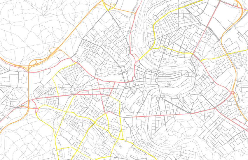
swissTLM3D Roads and Tracks
swissTLM3D road and tracks contains the road and path network Switzerland and the Principality of Liechtenstein. It is part of the dataset swissTLM3D. With a high accuracy and the incorporation of a third dimension, swissTLM3D is the most extensive 3D vector data set of Switzerland. In the federal geoportal the objects of the layer "road and tracks" are displayed gradually according to the different zoomlevels.
Simple
Identification info
- Alternate title
-
Roads and Tracks swissTLM3D
- Date (Creation)
- 2011-04-01
- Date (Revision)
- 2025-03-05
- Edition
-
Version 2.3
- Edition date
- 2025-03-05
- Citation identifier
- ch.swisstopo.swisstlm3d-strassen
Citation identifier
- Collective title
-
topographical landscape model (national survey)
- Status
- On going
Point of contact
Responsible party
- Organisation name
-
Federal Office of Topography swisstopo
- Position name
-
Geodata Distribution
- Voice
-
+41 58 469 01 11
- Facsimile
-
+41 58 469 04 59
Address
- City
-
Wabern
- Postal code
-
3084
- Country
-
CH
- Electronic mail address
- Streetname
-
Seftigenstrasse
- Streetnumber
-
264
- Protocol
-
WWW:LINK
- Role
- Point of contact
- Last Name
-
geodata
- Organisation Acronym
-
swisstopo
Point of contact
Responsible party
- Organisation name
-
Federal Office of Topography swisstopo
- Position name
-
Contact
- Voice
-
0041 58 469 01 11
- Facsimile
-
0041 58 469 04 59
Address
- City
-
Wabern
- Postal code
-
3084
- Electronic mail address
- Streetname
-
Seftigenstrasse
- Streetnumber
-
264
- Address line
-
Postfach
- Protocol
-
WWW:LINK
- Role
- Owner
- Organisation Acronym
-
swisstopo
- Maintenance and update frequency
- Annually
- Maintenance note
-
The existing data was migrated into the TLM as a basis. The data is now updated based on an update cycle of 3 years and improvements and additions are made to the geometries and attributes. Parallel to the three-year update process, an annual update is carried out through the integration of data from so-called reference partners for selected topics. Initially, this annual update is implemented mainly for the administrative boundaries, buildings and road links. The official cadastral survey plays an important role as a reference partner in this process. The nomenclature for updating names are also integrated from the official cadastral survey.
Appraisal AAP
- Duration of conservation
- 275
- Appraisal of archival value
- of archival value
- Reason for archiving value
- Evidence of business practice
-
geocat.ch
-
-
landscape model
-
traffic network
-
GIS (Geographic Information System)
-
opendata.swiss
-
Conservation and archiving planning AAP - Confederation
-
single object
-
official geodata
-
-
GEMET
-
-
motorway
-
vector
-
geographic information system
-
highway
-
-
GEMET - INSPIRE themes, version 1.0
-
-
Transport networks
-
Geographical names
-
-
geocat.ch
-
-
FSDI Federal Spatial Data Infrastructure
-
- Use constraints
- Other restrictions
- Other constraints
-
NonCommercialAllowed-CommercialAllowed-ReferenceRequired
- Aggregate Datasetindentifier
- 73856ca2-f21d-4cc9-90f6-f3e8375555df
- Association Type
- Larger work citation
- Spatial representation type
- Vector
- Denominator
- 5000
- Denominator
- 25000
- Language
- Deutsch
- Character set
- UTF8
- Topic category
-
- A Base Maps, Land Cover, Aerial and Satellite Imagery
- A1 Base Maps, Landscape Models
- P Transportation
Extent
- Description
-
Switzerland
))

Extent
- Description
-
Liechtenstein
))

- Basic geodata identifier
-
38.1
- Basic geodata identifier type
- Federal
- Geodata Type
- Reference Geodata
- Distribution format
-
-
ESRI File Geodatabase FileGDB (GDB)
()
-
ESRI Shapefile (SHP)
()
-
AutoCAD DXF (DXF)
()
-
INTERLIS 1 (ITF)
()
-
INTERLIS 2 (XTF)
()
-
OGC Geopackage (GPKG)
()
-
ESRI File Geodatabase FileGDB (GDB)
()
- OnLine resource
-
Preview map.geo.admin.ch
(
MAP:Preview
)
Preview map.geo.admin.ch
- OnLine resource
-
ch.swisstopo.swisstlm3d-strassen
(
OGC:WMS
)
WMS-FSDI service, layer "Roads and Tracks swissTLM3D"
- OnLine resource
-
ch.swisstopo.swisstlm3d-strassen
(
OGC:WMTS
)
WMTS-FSDI service, layer "Roads and Tracks swissTLM3D"
- OnLine resource
-
swissTLM3D
(
WWW:LINK
)
swissTLM3D
- OnLine resource
-
map.geo.admin.ch
(
CHTOPO:specialised-geoportal
)
map.geo.admin.ch
- OnLine resource
-
RESTful API from geo.admin.ch
(
ESRI:REST
)
RESTful API from geo.admin.ch
- OnLine resource
-
Permalink opendata.swiss
(
OPENDATA:SWISS
)
Permalink opendata.swiss
- Hierarchy level
- Dataset
- Statement
-
Geometric accuracy: from 0.2 -1.5 m in all three dimensions for well-defined landscape features such as roads and buildings, 1 - 3 m in all three dimensions for landscape features which are not clearly defined such as forests
- Reference system identifier
- EPSG:2056
- Reference system identifier
- EPSG:5728
Content Information
- Included with dataset
- Date (Revision)
- 2025-03-05
- Model type
- Feature description
Metadata
- Metadata language
- Deutsch
- Character set
- UTF8
- Hierarchy level
- Dataset
- Date stamp
- 2024-03-05T14:36:31.067Z
- Metadata standard name
-
GM03 2+
Metadata author
Responsible party
- Organisation name
-
Federal Office of Topography swisstopo
- Position name
-
Metadata contact
- Voice
-
+41 58 469 01 11
Address
- City
-
Wabern
- Postal code
-
3084
- Country
-
CH
- Electronic mail address
- Streetname
-
Seftigenstrasse
- Streetnumber
-
264
- Protocol
-
WWW:LINK
- Hours of service
-
08h30 - 11h00 / 14h00 - 16h00 GMT+1
- Role
- Point of contact
- Last Name
-
metadata
- Organisation Acronym
-
swisstopo