geocat.ch
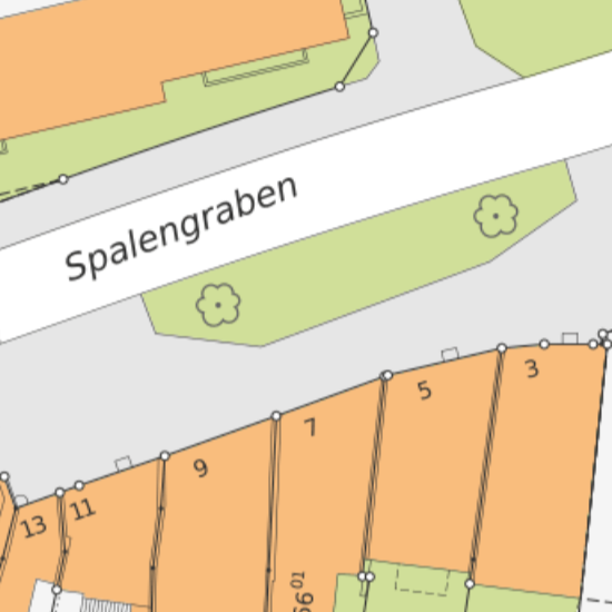
Parzellenplan Amtliche Vermessung 1:500 (Raster farbig)
Rasterplan der Amtlichen Vermessung im Massstab 1:500 farbig.
Simple
Informazioni di identificazione
- Data (Creazione)
- 1996-02-01
Responsabile
Servizio responsabile
- Nome dell'ente
-
Kanton Basel-Stadt
- Ruolo del responsabile
-
Bau- und Verkehrsdepartement
- Telefono
-
+41 (0)61 267 92 85
Indirizzo
- Protocollo
-
WWW:LINK
- Ruolo
- Author
- Nome
-
Grundbuch- und Vermessungsamt
- Cognome
-
Amtliche Vermessung
- Abbreviazione dell'organizzazione
-
BS-BVD-GVA-AV
- Titolo collettivo
-
Parzellenplan Amtliche Vermessung (Raster)
- Status
- Completato
Punto di contatto
Servizio responsabile
- Nome dell'ente
-
Kanton Basel-Stadt
- Ruolo del responsabile
-
Bau- und Verkehrsdepartement
- Telefono
-
+41 (0)61 267 92 85
Indirizzo
- Protocollo
-
WWW:LINK
- Ruolo
- Owner
- Nome
-
Grundbuch- und Vermessungsamt
- Cognome
-
Amtliche Vermessung
- Abbreviazione dell'organizzazione
-
BS-BVD-GVA-AV
- Frequenza di aggiornamento
- Semestrale
-
geocat.ch
-
-
misurazione ufficiale MU
-
-
geocat.ch
-
-
carta di base
-
-
geocat.ch
-
-
opendata.swiss
-
- Altri vincoli
-
Die Geodaten sind öffentlich zugänglich. (Zugangsberechtigungsstufe [A] = öffentlich)
- Altri vincoli
-
Es gelten die Nutzungsbedingungen für Geodaten des Kantons Basel-Stadt ( http://www.geo.bs.ch/agb)
- Identificatore aggregato del dataset
- dc551253-a419-40ba-a720-4ca4fb57886b
- Tipo di associazione
- Description
- Tipo di rappresentazione spaziale
- Dati raster
- Distanza
- 0.05 m
- Denominatore
- 500
- Lingua dei metadati
- Deutsch
- Set dei caratteri dei metadati
- UTF8
- Tema
-
- A Carte di base, copertura del suolo, immagini aeree
- A1 Carte di base, modelli del territorio
Estensione
- Descrizione
-
Cantone di Basilea Città (BS)
))

- Identificatore del geodato di base
-
8
- Genere dell'identificatore
- Cantone
- Geodata Type
- Open Data
- Formato di distribuzione
-
-
AutoCAD DXF (DXF)
()
-
AutoCAD DWG (DWG)
()
-
AutoCAD DXF (DXF)
()
Distributore
Servizio responsabile
- Nome dell'ente
-
Kanton Basel-Stadt
- Ruolo del responsabile
-
Bau- und Verkehrsdepartement
- Telefono
-
+41 (0)61 267 92 85
Indirizzo
- Protocollo
-
WWW:LINK
- Ruolo
- Distributor
- Nome
-
Grundbuch- und Vermessungsamt
- Cognome
-
Amtliche Vermessung
- Abbreviazione dell'organizzazione
-
BS-BVD-GVA-AV
- Risorsa online
-
MapBS
(
CHTOPO:specialised-geoportal
)
Öffentliches Auskunftssystem des Kantons Basel-Stadt
- Risorsa online
-
Geodaten-Shop
(
WWW:DOWNLOAD-APP
)
Öffentlich zugänglicher Geodaten-Downloaddienst des Kantons Basel-Stadt
- Risorsa online
-
WMS BS
(
OGC:WMS
)
Die derzeit im WMS BS verfügbaren Datenebenen entsprechen, bis auf wenige Ausnahmen, den Geodaten, welche auch in MapBS dargestellt sind. Der WMS BS ist kostenlos nutzbar und bietet Zugriff auf öffentliche sowie beschränkt öffentliche Geodaten, wobei gegebenenfalls Benutzername und Passwort benötigt werden (Zugangsdaten von MapBS).
- Risorsa online
-
Permalink opendata.swiss
(
OPENDATA:SWISS
)
Permalink opendata.swiss
- Identificatore del sistema di riferimento
- CH1903+ / LV95 / EPSG: 2056
Metadata
- Lingua dei metadati
- Deutsch
- Set dei caratteri dei metadati
- UTF8
- Livello gerarchico
- Set di dati
- Data dei metadati
- 2023-01-27T12:54:25.739Z
- Nome dello Standard dei metadati
-
GM03 Basel-Stadt
- Versione dello Standard dei metadati
-
2.0
Contatto
Servizio responsabile
- Nome dell'ente
-
Kanton Basel-Stadt
- Ruolo del responsabile
-
Bau- und Verkehrsdepartement
- Telefono
-
+41 (0)61 267 92 85
Indirizzo
- Protocollo
-
WWW:LINK
- Ruolo
- Custodian
- Nome
-
Grundbuch- und Vermessungsamt
- Cognome
-
Fachstelle für Geoinformation
- Abbreviazione dell'organizzazione
-
BS-BVD-GVA-FGI