geocat.ch
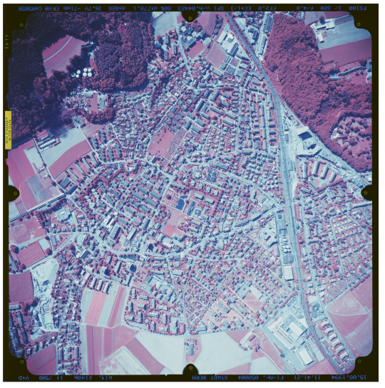
Aerial Images swisstopo infrared
The aerial imagery catalogue of swisstopo comprises around 360'000 analogue aerial photographs (black and white, colour or infrared colour). About 280'00 aerial images are represented by the centre-image coordinates, the image footprint as well as the attributed metadata and 265‘000 images of the collection have already been digitalised and can be viewed in their full resolution (as of October 2018). The remaining scanned images will be continuously integrated over the coming years. The aerial images can be ordered as digital files. If available, the orientation elements of the aerial images can be delivered as well.
Simple
Identification info
- Alternate title
-
Aerial Images swisstopo IR
- Date (Creation)
- 1927-01-01
- Citation identifier
- ch.swisstopo.lubis-luftbilder_infrarot
Citation identifier
- Collective title
-
Digital aerial photographs
Point of contact
Responsible party
- Organisation name
-
Federal Office of Topography swisstopo
- Position name
-
Geodata Distribution
- Voice
-
+41 58 469 01 11
- Facsimile
-
+41 58 469 04 59
Address
- City
-
Wabern
- Postal code
-
3084
- Country
-
CH
- Electronic mail address
- Streetname
-
Seftigenstrasse
- Streetnumber
-
264
- Protocol
-
WWW:LINK
- Role
- Owner
- Last Name
-
geodata
- Organisation Acronym
-
swisstopo
-
GEMET
-
-
aerial photograph
-
aerial photograph
-
-
GEMET - INSPIRE themes, version 1.0
-
-
Orthoimagery
-
-
geocat.ch
-
-
opendata.swiss
-
-
geocat.ch
-
-
FSDI Federal Spatial Data Infrastructure
-
- Other constraints
- Opendata BY: Open use. Must provide the source.
- Aggregate Datasetindentifier
- 376c3aaa-0b55-48d8-966d-38dd863ccc7e
- Association Type
- Larger work citation
- Language
- Deutsch
- Character set
- UTF8
- Topic category
-
- A Base Maps, Land Cover, Aerial and Satellite Imagery
- A3 Aerial and Satellite Imagery
Extent
- Description
-
Switzerland
))

Extent
- Description
-
Liechtenstein
))

- Basic geodata identifier
-
36.1
- Basic geodata identifier type
- Federal
- Distribution format
-
-
Cloud Optimized GeoTIFF (TIFF / TIF)
(
-
)
-
Cloud Optimized GeoTIFF (TIFF / TIF)
(
-
)
- OnLine resource
-
Preview map.geo.admin.ch
(
MAP:Preview
)
Preview map.geo.admin.ch
- OnLine resource
-
ch.swisstopo.lubis-luftbilder_infrarot
(
OGC:WMS
)
WMS-FSDI service, layer "Aerial Images swisstopo IR"
- OnLine resource
-
ch.swisstopo.lubis-luftbilder_infrarot
(
OGC:WMTS
)
WMTS-FSDI service, layer "Aerial Images swisstopo IR"
- OnLine resource
-
Metadata
(
WWW:DOWNLOAD-URL
)
Metadata
- OnLine resource
- Webpage aerial photographs ( WWW:LINK )
- OnLine resource
- LUBIS-Viewer ( CHTOPO:specialised-geoportal )
- OnLine resource
- Link for data access ( WWW:DOWNLOAD-URL )
- OnLine resource
-
RESTful API from geo.admin.ch
(
ESRI:REST
)
RESTful API from geo.admin.ch
- OnLine resource
-
Permalink opendata.swiss
(
OPENDATA:SWISS
)
Permalink opendata.swiss
Metadata
- Metadata language
- Deutsch
- Character set
- UTF8
- Hierarchy level
- Dataset
- Date stamp
- 2024-11-15T09:24:36.535Z
- Metadata standard name
-
GM03 2+
Metadata author
Responsible party
- Organisation name
-
Federal Office of Topography swisstopo
- Position name
-
Metadata contact
- Voice
-
+41 58 469 01 11
Address
- City
-
Wabern
- Postal code
-
3084
- Country
-
CH
- Electronic mail address
- Streetname
-
Seftigenstrasse
- Streetnumber
-
264
- Protocol
-
WWW:LINK
- Hours of service
-
08h30 - 11h00 / 14h00 - 16h00 GMT+1
- Role
- Point of contact
- Last Name
-
metadata
- Organisation Acronym
-
swisstopo