geocat.ch
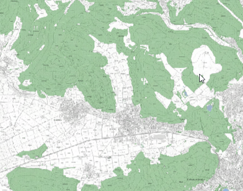
Übersichtsplan Kanton Schaffhausen
Der Übersichtsplan ist ein automatisch generierter Rasterplan, basierend auf der amtlichen Vermessung, mit einer standardisierten Darstellung. Darin enthalten sind die Grundstücksgrenzen, Gebäude, Strassen und Wege, Wald, bestockte Flächen, Gewässer und Höhenkurven (10m, ausserhalb der Bauzonen) sowie die Beschriftungen von Grundstücksnummern, Strassennamen, Flurnamen, Gewässernamen. Der Übersichtsplan liegt als Kachelplan in Graustufen oder farbig vor.
Simple
Identification info
- Date (Revision)
- 2024-11-20
- Date (Creation)
- 2011-08-29
Citation identifier
- Status
- On going
Point of contact
Responsible party
- Organisation name
-
Amt für Geoinformation des Kantons Schaffhausen
- Position name
-
Kontakt
Address
- Website
- https://sh.ch/CMS/Webseite/Kanton-Schaffhausen/Beh-rde/Verwaltung/Volkswirtschaftsdepartement/Amt-f-r-Geoinformation-3854-DE.html ( WWW:LINK )
- Role
- Point of contact
- Organisation Acronym
-
AGI
Point of contact
Responsible party
- Organisation name
-
Amt für Geoinformation des Kantons Schaffhausen
- Position name
-
Kontakt
Address
- Website
- https://sh.ch/CMS/Webseite/Kanton-Schaffhausen/Beh-rde/Verwaltung/Volkswirtschaftsdepartement/Amt-f-r-Geoinformation-3854-DE.html ( WWW:LINK )
- Role
- Owner
- Organisation Acronym
-
AGI
- Maintenance and update frequency
- Weekly
Appraisal AAP
- Duration of conservation
- 0
- Comment on duration of conservation
-
Aufbewahrungsfrist unbekannt.
- Appraisal of archival value
- of archival value
- Reason for archiving value
- Evidence of business practice
-
-
Übersichtsplan
-
opendata.swiss
-
- Other constraints
- Freie Nutzung
- Language
- Deutsch
- Character set
- UTF8
- Topic category
-
- A3 Aerial and Satellite Imagery
Extent
- Description
-
Kanton Schaffhausen
))

- Geodata Type
- Open Government Data
- Distribution format
-
-
WMS Dienst
(
)
-
WMS Dienst
(
)
Distributor contact
Responsible party
- Organisation name
-
Amt für Geoinformation des Kantons Schaffhausen
Address
- Website
- https://sh.ch/CMS/Webseite/Kanton-Schaffhausen/Beh-rde/Verwaltung/Volkswirtschaftsdepartement/Amt-f-r-Geoinformation-3854-DE.html ( WWW:LINK )
- Role
- Distributor
- Organisation Acronym
-
AGI
- OnLine resource
-
(TIF farbig)
(
WWW:DOWNLOAD-URL
)
(TIF farbig)
- OnLine resource
-
(TIF grau)
(
WWW:DOWNLOAD-URL
)
(TIF grau)
- OnLine resource
-
Kanton Schaffhausen
(
OGC:WMS-http-get-capabilities
)
Kanton Schaffhausen
- OnLine resource
-
Kanton Schaffhausen
(
CHTOPO:specialised-geoportal
)
Kanton Schaffhausen
- Reference system identifier
- 2056
Metadata
- Metadata language
- Deutsch
- Character set
- UTF8
- Hierarchy level
- Dataset
- Date stamp
- 2024-11-20T00:00:00
- Metadata standard name
-
GM03 2+
Metadata author
Responsible party
- Organisation name
-
Amt für Geoinformation des Kantons Schaffhausen
- Position name
-
Kontakt
Address
- Website
- https://sh.ch/CMS/Webseite/Kanton-Schaffhausen/Beh-rde/Verwaltung/Volkswirtschaftsdepartement/Amt-f-r-Geoinformation-3854-DE.html ( WWW:LINK )
- Role
- Point of contact
- Organisation Acronym
-
AGI
- Maintenance and update frequency
- Weekly