geocat.ch
Nutzungsplanung: Zonenpläne
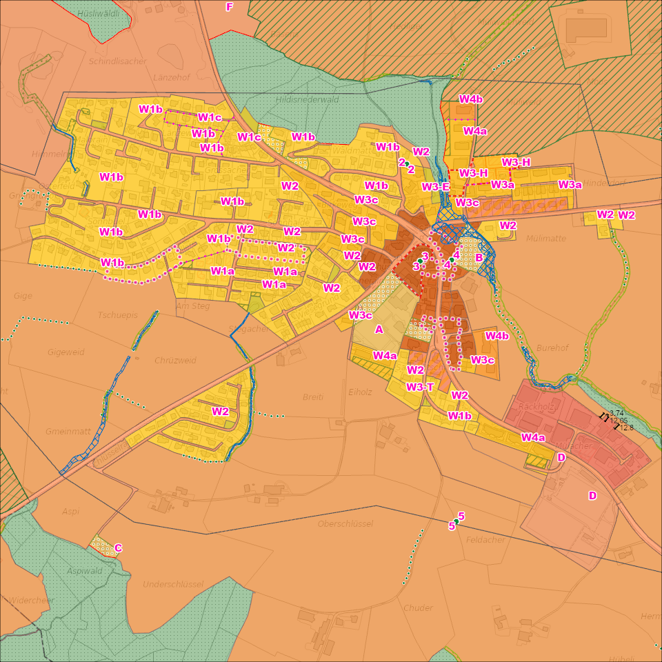
Zonenpläne sind grundeigentümerverbindlich und regeln die zulässige Art der Bodennutzung im Gebiet einer Gemeinde.
Simple
Informazioni di identificazione
- Titolo alternativo
-
ZONPLANX_COL
- Data (Creazione)
- 2025-04-27
- Formato di presentazione
- Mappa digitale
- Finalità
-
Mit den kommunalen Zonenplänen ordnen die Gemeinden die zulässige Nutzung ihres Gebietes. Sie regeln insbesondere die Abgrenzung des Baugebietes vom Nicht-Baugebiet und setzen Art und Mass der zulässigen baulichen Nutzung fest.Im zugehörigen Bau- und Zonenreglement (BZR) legen die Gemeinden für alle Zonen die Art und Dichte der Nutzung sowie gestalterische, erschliessungstechnische, umweltrechtliche und weitere Vorgaben fest.Zonenplan und BZR werden von den Stimmberechtigten oder vom Gemeindeparlament erlassen. Sie bedürfen der Genehmigung des Regierungsrates.Alle kommunalen Zonenpläne werden nach einheitlichen Richtlinien erstellt. Grundlage dazu ist das vom Raumdatenpool erstellte Datenmodell und Nachführungskonzept Nutzungsplanung (Version 3.x).
- Status
- In corso
Punto di contatto
Servizio responsabile
- Nome dell'ente
-
Kanton Luzern, Abteilung Geoinformation
- Telefono
-
041 228 51 83
Indirizzo
- Risorsa online
- https://geoportal.lu.ch/ ( https )
- Ruolo
- Publisher
Punto di contatto
Servizio responsabile
- Nome dell'ente
-
Raumdatenpool Kanton Luzern
Indirizzo
- Città
-
Luzern
- Codice postale
-
6002
- Nazione
-
CH
- Via
-
Murbacherstrasse
- Numero
-
21
- Ruolo
- Owner
- Cognome
-
Raumdatenpool Kanton Luzern
- Abbreviazione dell'organizzazione
-
RDP
- Frequenza di aggiornamento
- Continuo
-
geocat.ch
-
-
opendata.swiss
-
Baulinie
-
Eigentumsbeschränkung/ÖREB
-
Grundeigentum
-
Nutzungsplanung
-
Raumplanung
-
Zonenplan
-
- Vincoli di accesso
- none
- Vincoli di fruibilità
- Proprietà intellettuale dei dati
- Limitazione d’uso
-
öffentlich zugängliche Geobasisdaten
- Vincoli di accesso
- none
- Vincoli di fruibilità
- none
- Limitazione d’uso
-
Freie Nutzung. Quellenangabe ist Pflicht
- Identificatore aggregato del dataset
- b2f107ec-2c6f-490f-a114-1d0caf2b0d6e
- Tipo di associazione
- Larger work citation
- Tipo di rappresentazione spaziale
- undefined
- Lingua dei metadati
- Deutsch
- Set dei caratteri dei metadati
- UTF8
- Tema
-
- E Pianificazione territoriale, catasto fondiario
- E1 Pianificazione e sviluppo territoriale
- Descrizione
-
Kanton Luzern
))
- Formato di distribuzione
-
-
ESRI Geodatabase (.gdb)
(
)
-
ESRI Shapefile (.shp)
(
)
-
OGC GeoPackage (.gpkg)
(
)
-
INTERLIS (.itf/.xtf)
(
)
-
ESRI Geodatabase (.gdb)
(
)
Distributore
Servizio responsabile
- Nome dell'ente
-
Dienststelle Raum und Wirtschaft (rawi)
- Telefono
-
041 228 51 83
Indirizzo
- Risorsa online
- https://geoportal.lu.ch ( https )
- Ruolo
- Point of contact
- Nome
-
Geodaten
- Cognome
-
Kanton Luzern
- Abbreviazione dell'organizzazione
-
rawi
- Risorsa online
-
Datenshop
(
https
)
Produktansicht Geodatenshop
- Livello
- Set di dati
- Genealogia del dato – Processo di produzione
-
unbekannt
- Identificatore del sistema di riferimento
- CH1903+
Metadata
- Lingua dei metadati
- Deutsch
- Set dei caratteri dei metadati
- UTF8
- Livello gerarchico
- Set di dati
- Data dei metadati
- 2025-04-19
- Nome dello Standard dei metadati
-
GM03 2+
Contatto
Servizio responsabile
- Nome dell'ente
-
Dienststelle Raum und Wirtschaft (rawi)
- Telefono
-
041 228 51 83
Indirizzo
- Città
-
Luzern
- Codice postale
-
6002
- Nazione
-
CH
- Via
-
Murbacherstrasse
- Numero
-
21
- Risorsa online
- https://geoportal.lu.ch ( https )
- Ruolo
- Point of contact
- Nome
-
PhulbaDoma
- Cognome
-
Lama
- Abbreviazione dell'organizzazione
-
rawi
- Frequenza di aggiornamento
- Secondo necessità