geocat.ch
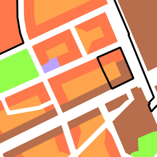
Zonenplan Stadt Basel
Der Zonenplan legt Ort, Art und Mass der Bodennutzung für ein bestimmtes Gebiet parzellenscharf und grundeigentümerverbindlich fest.
Simple
Informazioni di identificazione
- Data (Creazione)
- 2004-01-01
Responsabile
Servizio responsabile
- Nome dell'ente
-
Kanton Basel-Stadt
- Ruolo del responsabile
-
Bau- und Verkehrsdepartement
- Telefono
-
+41 (0)61 267 92 25
Indirizzo
- Protocollo
-
WWW:LINK
- Ruolo
- Author
- Nome
-
Städtebau & Architektur
- Cognome
-
Planungsamt
- Abbreviazione dell'organizzazione
-
BS-BVD-S+A-P
- Titolo collettivo
-
Nutzungsplanung (Gemeinden Basel)
- Status
- Completato
Punto di contatto
Servizio responsabile
- Nome dell'ente
-
Kanton Basel-Stadt
- Ruolo del responsabile
-
Bau- und Verkehrsdepartement
- Telefono
-
+41 (0)61 267 92 25
Indirizzo
- Protocollo
-
WWW:LINK
- Ruolo
- Owner
- Nome
-
Städtebau & Architektur
- Cognome
-
Planungsamt
- Abbreviazione dell'organizzazione
-
BS-BVD-S+A-P
- Frequenza di aggiornamento
- Continuo
-
GEMET
-
-
piano di uso del suolo
-
-
geocat.ch
-
-
opendata.swiss
-
- Altri vincoli
-
Die Geodaten sind öffentlich zugänglich. (Zugangsberechtigungsstufe [A] = öffentlich)
- Altri vincoli
-
Es gelten die Nutzungsbedingungen für Geodaten des Kantons Basel-Stadt. ( http://www.geo.bs.ch/agb)
- Identificatore aggregato del dataset
- d5df9fc5-10e2-4fa7-8c7e-bbd60bed9228
- Tipo di associazione
- Description
- Tipo di rappresentazione spaziale
- Dati vettoriali
- Lingua dei metadati
- Deutsch
- Set dei caratteri dei metadati
- UTF8
- Tema
-
- E Pianificazione territoriale, catasto fondiario
- E1 Pianificazione e sviluppo territoriale
Estensione
- Descrizione
-
Basel
))

Estensione
- Descrizione
-
Bettingen
))

- Geodata Type
- Open Data
- Formato di distribuzione
-
-
AutoCAD DXF (DXF)
()
-
AutoCAD DWG (DWG)
()
-
ESRI Shapefile (SHP)
()
-
INTERLIS 1 (ITF)
()
-
AutoCAD DXF (DXF)
()
Distributore
Servizio responsabile
- Nome dell'ente
-
Kanton Basel-Stadt
- Ruolo del responsabile
-
Bau- und Verkehrsdepartement
- Telefono
-
+41 (0)61 267 92 85
Indirizzo
- Protocollo
-
WWW:LINK
- Orario di apertura
-
Mo - Do: 8:00 bis 12:00, 13:30 bis 16:30, Fr: 8:00 bis 12:00, 13:30 bis 16:00
- Ruolo
- Distributor
- Nome
-
Grundbuch- und Vermessungsamt
- Abbreviazione dell'organizzazione
-
BS-BVD-GVA-KZ
- Risorsa online
-
MapBS
(
CHTOPO:specialised-geoportal
)
Öffentliches Auskunftssystem des Kantons Basel-Stadt
- Risorsa online
-
Geodaten-Shop
(
WWW:DOWNLOAD-APP
)
Öffentlich zugänglicher Geodaten-Downloaddienst des Kantons Basel-Stadt
- Risorsa online
-
WMS BS
(
OGC:WMS
)
Die derzeit im WMS BS verfügbaren Datenebenen entsprechen, bis auf wenige Ausnahmen, den Geodaten, welche auch in MapBS dargestellt sind. Der WMS BS ist kostenlos nutzbar und bietet Zugriff auf öffentliche sowie beschränkt öffentliche Geodaten, wobei gegebenenfalls Benutzername und Passwort benötigt werden (Zugangsdaten von MapBS).
- Risorsa online
-
WFS BS
(
OGC:WFS
)
Die derzeit im WFS BS verfügbaren Datenebenen entsprechen, bis auf wenige Ausnahmen, den Geodaten, welche auch in MapBS dargestellt sind. Der WFS BS ist kostenlos nutzbar und bietet Zugriff auf öffentliche sowie beschränkt öffentliche Geodaten, wobei gegebenenfalls Benutzername und Passwort benötigt werden (Zugangsdaten von MapBS).
- Risorsa online
-
Permalink opendata.swiss
(
OPENDATA:SWISS
)
Permalink opendata.swiss
- Identificatore del sistema di riferimento
- CH1903+ / LV95 / EPSG: 2056
Metadata
- Lingua dei metadati
- Deutsch
- Set dei caratteri dei metadati
- UTF8
- Livello gerarchico
- Set di dati
- Data dei metadati
- 2025-01-29T15:25:18.838Z
- Nome dello Standard dei metadati
-
GM03 Basel-Stadt
- Versione dello Standard dei metadati
-
2.0
Contatto
Servizio responsabile
- Nome dell'ente
-
Kanton Basel-Stadt
- Ruolo del responsabile
-
Bau- und Verkehrsdepartement
- Telefono
-
+41 (0)61 267 92 85
Indirizzo
- Protocollo
-
WWW:LINK
- Ruolo
- Custodian
- Nome
-
Grundbuch- und Vermessungsamt
- Cognome
-
Fachstelle für Geoinformation
- Abbreviazione dell'organizzazione
-
BS-BVD-GVA-FGI