geocat.ch
VECTOR25 Buildings
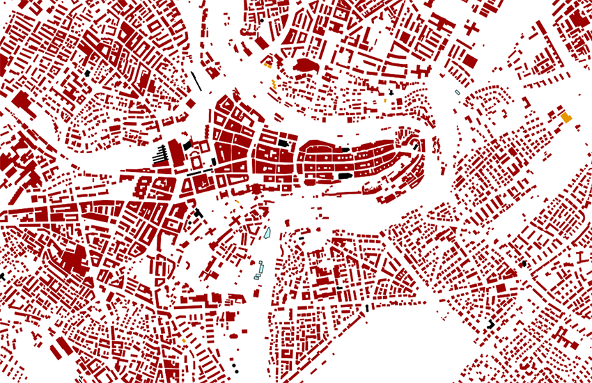
The layer buildings (abbrev "geb") contains all of the "building data" of the National Map 1:25 000 as surface objects. The classification includes all of the object types which could be identified on the basic of the map legend.
Simple
Identification info
- Alternate title
-
Buildings VECTOR25
- Date (Publication)
- 2008-08-31
- Citation identifier
- ch.swisstopo.vec25-gebaeude
Citation identifier
- Other citation details
-
Part of the vECTOR25 Dataset
- Collective title
-
Topografisches Landschaftsmodell (Landesvermessung)
- Status
- Completed
Point of contact
Responsible party
- Organisation name
-
Federal Office of Topography swisstopo
- Position name
-
Geodata Distribution
- Voice
-
+41 58 469 01 11
- Facsimile
-
+41 58 469 04 59
Address
- City
-
Wabern
- Postal code
-
3084
- Country
-
CH
- Electronic mail address
- Streetname
-
Seftigenstrasse
- Streetnumber
-
264
- Protocol
-
WWW:LINK
- Role
- Point of contact
- Last Name
-
geodata
- Organisation Acronym
-
swisstopo
- Maintenance and update frequency
- Not planned
- Update scope
- Dataset
- Maintenance note
-
Since 2008 not updated anymore
- Name
-
ESRI ArcInfo coverage (COV)
-
geocat.ch
-
-
castle
-
e-geo.ch
-
landscape model
-
GIS (Geographic Information System)
-
-
GEMET
-
-
church
-
geographic information system
-
-
GEMET - INSPIRE themes, version 1.0
-
-
Buildings
-
-
geocat.ch
-
-
FSDI Federal Spatial Data Infrastructure
-
- Use constraints
- License
- Aggregate Datasetindentifier
- aee4fe79-a583-46a1-bf46-19ee613ce415
- Association Type
- Larger work citation
- Spatial representation type
- Vector
- Denominator
- 25000
- Language
- Deutsch
- Language
- English
- Character set
- UTF8
- Topic category
-
- O Buildings, Infrastructure, Facilities
- Environment description
-
ARC/INFO
Extent
- Description
-
National Map 1:25'000
))

- Geographic identifier
- NM25
- Supplemental Information
-
The layers Road network, Railway network, Other traffic, Hydrographic network, Primary surfaces, Buildings, Hedges and trees, Functional surfaces and Single objects build together the dataset VECTOR25.
- Revision Scope
- Dataset
- Distribution format
-
-
AutoCAD DXF (DXF)
()
-
ESRI Shapefile (SHP)
()
-
AutoCAD DXF (DXF)
()
- OnLine resource
-
Preview map.geo.admin.ch
(
MAP:Preview
)
Preview map.geo.admin.ch
- OnLine resource
-
ch.swisstopo.vec25-gebaeude
(
OGC:WMS
)
WMS-FSDI service, layer "Buildings VECTOR25"
- OnLine resource
-
ch.swisstopo.vec25-gebaeude
(
OGC:WMTS
)
WMTS-FSDI service, layer "Buildings VECTOR25"
- OnLine resource
-
map.geo.admin.ch
(
CHTOPO:specialised-geoportal
)
map.geo.admin.ch
- OnLine resource
-
RESTful API from geo.admin.ch
(
ESRI:REST
)
RESTful API from geo.admin.ch
- Hierarchy level
- Dataset
- Statement
-
Content and geometry based on the swiss National Map 1:25'000. Geometric precision : 3-8 m.
- Topology level
- Full planar graph
- Geometric object type
- Surface
- Geometric object count
- 2100000
- Geometric object type
- Curve
- Geometric object count
- 2100000
- Reference system identifier
- EPSG:21781
Content Information
- Compliance code
- Metadata language
- Deutsch
- Metadata language
- Français
- Included with dataset
- Date (Publication)
- 2007-06-01
- Presentation form
- Digital document
- Model type
- Feature description
Metadata
- Metadata language
- Deutsch
- Character set
- UTF8
- Hierarchy level
- Dataset
- Hierarchy level name
-
Layer
- Date stamp
- 2022-05-13T07:49:16
- Metadata standard name
-
GM03 2+
Metadata author
Responsible party
- Organisation name
-
Federal Office of Topography swisstopo
- Position name
-
Metadata contact
- Voice
-
+41 58 469 01 11
Address
- City
-
Wabern
- Postal code
-
3084
- Country
-
CH
- Electronic mail address
- Streetname
-
Seftigenstrasse
- Streetnumber
-
264
- Protocol
-
WWW:LINK
- Hours of service
-
08h30 - 11h00 / 14h00 - 16h00 GMT+1
- Role
- Point of contact
- Last Name
-
metadata
- Organisation Acronym
-
swisstopo
- Maintenance and update frequency
- As needed
Legislation Information
- Country
- Switzerland
- Language
- German
- Language
- French
- Language
- Italien
- Legislation Type
- Other legal text on national level
- Internal Reference
-
510.620
- Alternate title
-
Geoinformationsverordnung GeoIV
- Date (Creation)
- 2008-05-21
- Date (Publication)
- 2008-07-01
- Other citation details
-
Im Anhang 1 werden alle Geodaten aufgelistet, welche über ein gesetzliche Grundlage auf Bundesebene verfügen.